Bike Route Planner Simulator
Plan Your Bike Route
Route Preferences
Route Simulation Result
Planning a bike ride shouldn’t feel like solving a puzzle. Whether you're commuting to work in Mumbai or exploring quiet backroads on weekends, Google Maps can show you the safest, smoothest, and most efficient bike routes - if you know how to use it right. Most people think Google Maps is just for driving, but it’s got a hidden feature built just for cyclists. And it’s not just about avoiding traffic. It’s about finding bike lanes, avoiding steep hills, skipping busy intersections, and even spotting water fountains or repair shops along the way.
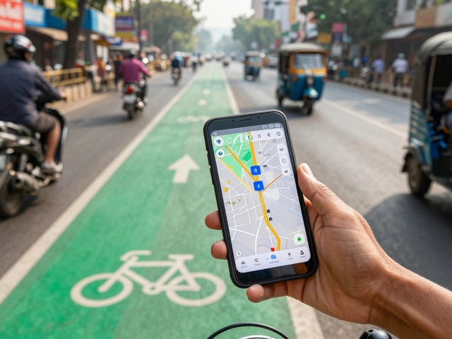
Turn on Bike Mode in Google Maps
Before you start, make sure you’re in bike mode. Open Google Maps on your phone or desktop. Tap the directions icon (it looks like a compass or a car). Then, instead of selecting Car, Walking, or Transit, look for the bicycle icon - it’s usually at the bottom of the list. Tap it. That’s it. Now Google Maps switches from car routing to bike routing. It starts calculating paths that include dedicated bike lanes, shared paths, and low-traffic streets. It ignores highways, toll roads, and areas where bikes aren’t allowed.
If you don’t see the bike icon, swipe left on the transportation options. Sometimes it hides under "More". On desktop, click the directions button, then click the bicycle symbol in the toolbar above the map. Once selected, your route will update automatically.
What Makes a Good Bike Route in Google Maps?
Not all bike routes are created equal. Google Maps doesn’t just pick the shortest path - it picks the safest one. Here’s what it considers:
- Bike lanes - Painted lanes on the side of roads, separated from cars.
- Shared paths - Trails or sidewalks where bikes and pedestrians share space (marked with dotted lines on the map).
- Low-traffic streets - Quiet residential roads with little or no car flow.
- Trail connections - Parks, river paths, or greenways that are bike-friendly.
It avoids:
- Highways and expressways
- Streets without bike infrastructure
- Steep hills (unless there’s no alternative)
- Areas with heavy traffic lights or complex intersections
For example, if you’re biking from Andheri to Juhu in Mumbai, Google Maps might route you through the Jogeshwari-Vikhroli Link Road instead of the main Western Express Highway - even if it’s longer. Why? Because the Link Road has bike lanes and fewer trucks. That’s the kind of smart routing you get.
Use the Layers Feature to See Bike Infrastructure
Google Maps has a secret tool called "Layers". Tap the square icon in the top-right corner (it looks like a stack of papers). Then, turn on "Bicycling". This overlay shows you every bike lane, trail, and path in the area. Suddenly, you’ll see green lines snaking through neighborhoods you didn’t know had bike infrastructure. In Mumbai, this reveals hidden gems like the Powai Lake cycling path, the Aarey Forest trail, or the Bandra-Worli Sea Link’s dedicated bike lane.
Don’t ignore this layer. It’s like turning on night vision. You’ll spot routes you never knew existed - and avoid dangerous ones you thought were safe.
Customize Your Route Preferences
Google Maps lets you tweak what kind of ride you want. After selecting bike mode, tap the three dots (⋯) next to the destination. Choose "Route options". Here, you can toggle two settings:
- Avoid hills - If you’re not in great shape or carrying groceries, turn this on. It reroutes you onto flatter roads, even if it adds a few minutes.
- Avoid tolls - This doesn’t matter for bikes since there are no bike tolls. But if you’re using a cargo bike or e-bike, this setting helps avoid areas where motor vehicles are restricted.
For daily commuters, avoiding hills can save energy. For weekend riders, it might mean the difference between finishing your ride feeling great or exhausted.
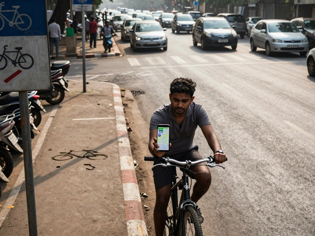
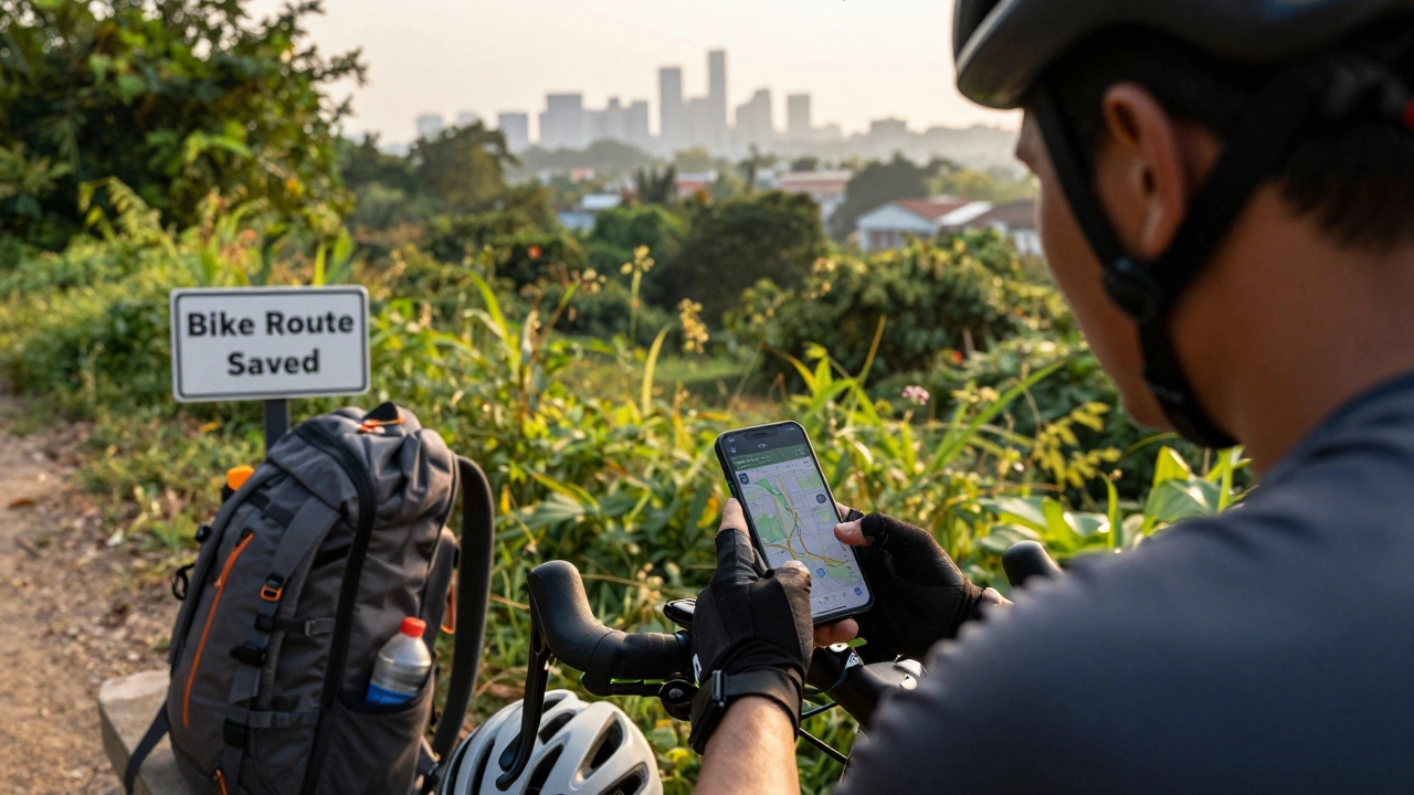
Save and Share Your Favorite Routes
Found a perfect route from Vile Parle to Marine Drive? Save it. Tap the route, then tap "Save". You can add it to a custom list like "Weekend Rides" or "Commute Paths". Later, you can pull it up instantly - even offline if you’ve downloaded the area.
Want to share a route with a friend? Tap "Share" and send the link via WhatsApp, SMS, or email. They’ll open it in their own Google Maps and follow the same path. This is perfect for group rides or when you’re meeting someone at a café along the way.
Use It Offline - Critical for Long Rides
Cell service dies. Especially on the outskirts of Mumbai, near Sanjay Gandhi National Park or along the Thane Creek. Before you head out, download the map area. Open Google Maps, search for your destination, then tap the name at the bottom. Scroll down and tap "Download". Choose the area you’ll cover. Now, even without data, your route stays visible. You’ll still get turn-by-turn voice guidance (if you’ve enabled it).
Pro tip: Download maps for the entire route - not just your start and end points. You never know when you’ll detour to grab a snack or take a scenic loop.
Real-World Tips for Indian Cities
Google Maps works well in big cities, but it’s not perfect - especially in places like Mumbai, Delhi, or Bangalore where infrastructure changes fast.
- Check recent reviews - Look at the comments on the route. Other cyclists might warn you about a broken path, a blocked lane, or construction.
- Verify with local groups - Join a Mumbai cycling Facebook group or Telegram channel. They often post updates about new bike lanes or road closures.
- Watch for potholes - Google Maps doesn’t show potholes. Use your eyes. If a route looks rough on Street View, take it slow.
- Use Street View - Tap the yellow pegman icon and drag it onto the road. Look ahead. Can you see a bike lane? Is there a gap in the pavement? Are there parked cars blocking the path? This saves you from nasty surprises.
One rider in Thane told me they followed Google Maps to a "bike path" - only to find it ended at a construction site. The app didn’t know about the recent roadwork. Always cross-check.
Combine It With Other Tools
Google Maps is great, but it’s not the whole toolkit. Pair it with:
- Strava - Track your ride, see where others ride, and find popular routes.
- MapMyRide - Offers detailed elevation data and real-time alerts.
- Waze - For real-time traffic and road hazards (though it’s car-focused, cyclists can still use it for construction warnings).
Use Google Maps to plan. Use Strava to record. Use Waze for last-minute alerts. Together, they make a powerful trio.
Why This Matters for Daily Life
Biking isn’t just exercise - it’s freedom. In Mumbai, where traffic jams last hours and parking costs ₹500 a day, a bike route that cuts your commute from 90 minutes to 40 minutes is life-changing. Google Maps doesn’t just help you ride - it helps you reclaim time, money, and sanity.
One user in Borivali started biking to work after discovering a quiet path through the Sanjay Gandhi National Park. They lost 8 kg in six months. Another in Kandivali found a 12-kilometer route that saved them ₹3,000 a month on fuel. These aren’t stories - they’re everyday wins.
Google Maps won’t fix bad infrastructure. But it can help you navigate around it. And sometimes, that’s enough to make cycling not just possible - but enjoyable.
Can Google Maps show bike lanes in real time?
Yes, but only if the data is updated. Google Maps uses crowdsourced data from cyclists, local governments, and satellite imagery. In major cities like Mumbai, bike lanes are usually marked within a few weeks of being installed. But in smaller towns, updates can lag. Always check recent reviews or local cycling groups for the latest info.
Does Google Maps work for e-bikes?
Yes, but with a catch. Google Maps treats e-bikes the same as regular bikes. It doesn’t adjust for battery range or speed. So if you’re on a long ride, plan for charging stops. Use apps like PlugShare or local e-bike groups to find charging stations along your route.
Why does Google Maps sometimes send me on sidewalks?
In areas with no bike lanes, Google Maps defaults to sidewalks if they’re marked as shared paths. This is common in dense urban areas like Mumbai’s suburbs. But not all sidewalks are safe for bikes - especially near schools or crowded markets. Use Street View to check if the path is wide enough and if pedestrians are allowed. When in doubt, take the quiet road.
Can I use Google Maps without an internet connection?
Yes, but only if you download the map area ahead of time. Go to the destination, tap "Download", and select the region. Once downloaded, you’ll see the map and get turn-by-turn directions without data. Voice guidance works too. Just make sure your phone’s GPS is on.
How accurate is the elevation data for hills?
Google Maps gives a rough estimate. It’s good enough to avoid the steepest climbs, but not precise for serious training. For accurate elevation, use Strava or Komoot. They use GPS and satellite data to show exact climbs. But for casual riders, Google’s hill warnings are reliable enough to plan your energy.